A field guide · Interesting Places and Facts

Found
Underground

Nineteen places in India that lay under farmland, sand, water or a later city — towns, monasteries and temples that had to be dug back out.

19 sites 12 states 3000 BCE — 16th c. CE

Most of India's past is not ruined. It is buried. Rivers shift and drop silt, wind piles up sand, villages build on the old mound because it is the high, dry ground. A city can disappear without ever being destroyed, simply by being covered.

The places in this guide all came back the same way: someone dug. A coconut grove near Madurai turned out to hold a brick town with drains and written pots. A hillock in a Bengal village turned out to be a monastery. A Delhi fort turned out to sit on two and a half thousand years of earlier cities. In other places, nature or people covered something on purpose, or by accident. Konark's great hall was filled with sand in 1903 to stop it falling down. Nagarjunakonda was taken apart and rebuilt on a hilltop before a dam drowned the valley.

Each entry gives the date or figure that matters most: when the digging started, how big the find was, or when it was covered. Where a claim rests on tradition or is still argued over, the entry says so. Most of these sites are open to visit, and several have small site museums. All of them began as short films on the channel.
Chapter One

Towns Under the Fields

Eight places where an entire settlement lay under farmland, scrub or a later city, and came back one trench at a time. Some are still being dug.

2015digging began KeezhadiSivaganga, Tamil Nadu
Sangam era
9.8631, 78.1821Open in Maps →
Keezhadi
Ssriram mt · CC BY-SA 4.0

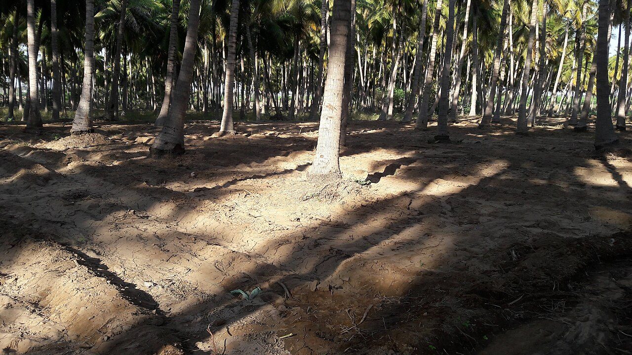
A coconut grove that was hiding a town

Trial trenches opened in a coconut grove near Madurai in 2015 found brick houses, covered drains, ring wells made of stacked clay rings, furnaces, dice and spindle whorls. Pots carried names scratched in Tamil-Brahmi script by ordinary people.

The Tamil Nadu archaeology department dates the earliest layers to around the 6th century BCE, which pushes urban life in the region back by centuries. Almost nothing religious was found. Keezhadi was a working town, and a site museum now stands beside it.

7thcentury, Lakshmana temple SirpurMahasamund, Chhattisgarh
5th — 12th c. CE
21.3452, 82.1848Open in Maps →
Sirpur
Mohnish1208 · CC BY-SA 3.0

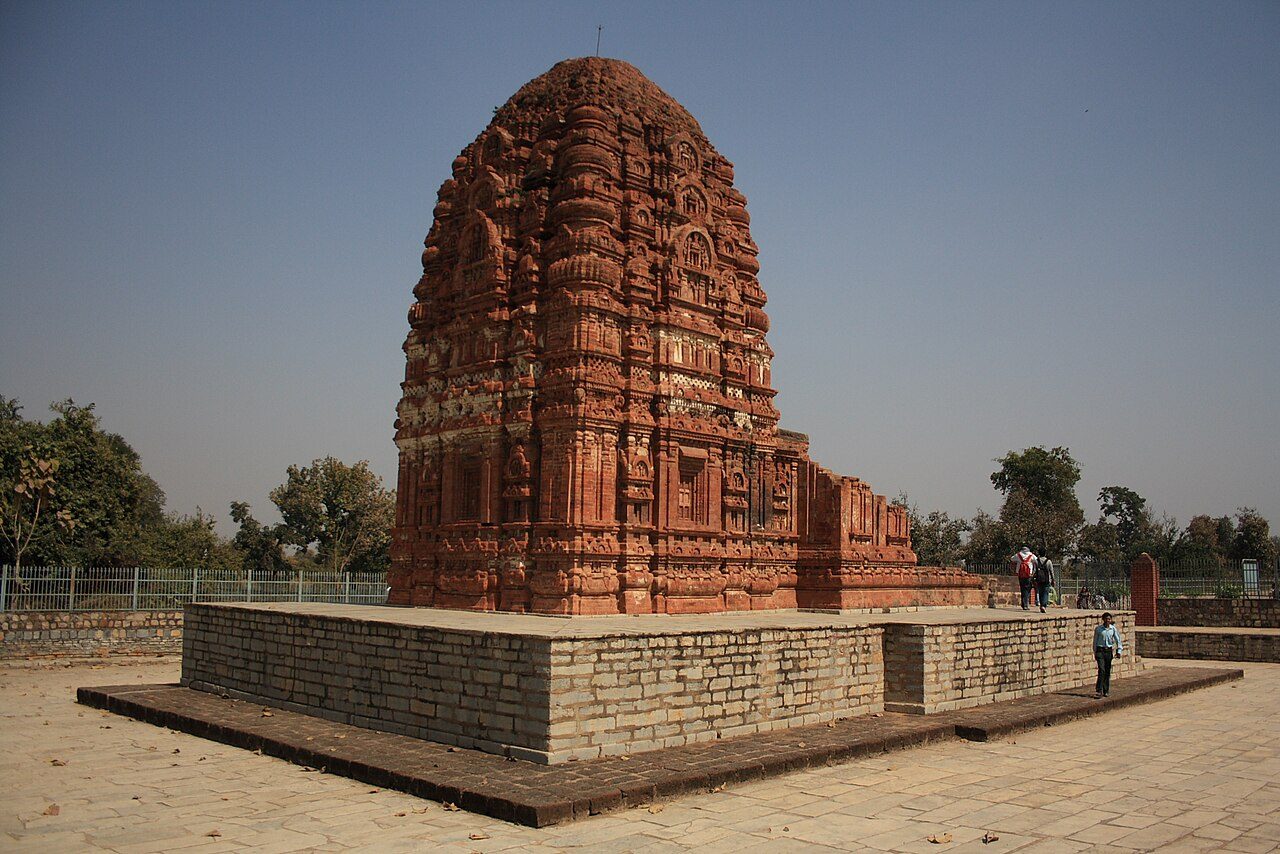
A capital that went back to being farmland

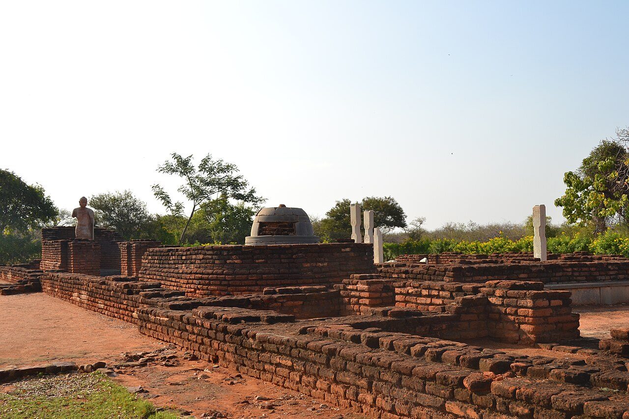
On the Mahanadi, Sirpur was a royal capital with Buddhist monasteries, Hindu and Jain temples, markets and bathing houses. Over centuries it sank under fields and forest, and villagers farmed on top of it.

Excavations, especially from the 2000s, exposed dozens of structures. The brick Lakshmana temple survived above ground the whole time, and is one of the finest brick temples in India. Its doorway carvings are still sharp.

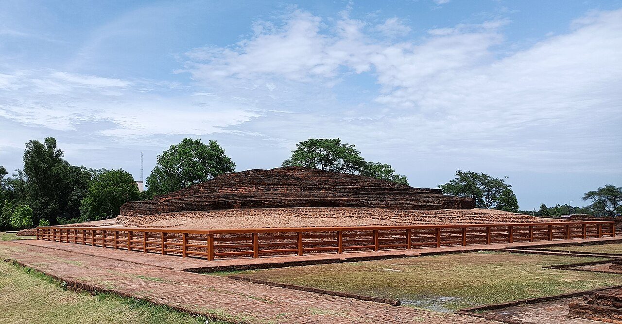
1957first excavated ChandraketugarhNorth 24 Parganas, West Bengal
c. 3rd c. BCE onward
22.6978, 88.6883Open in Maps →
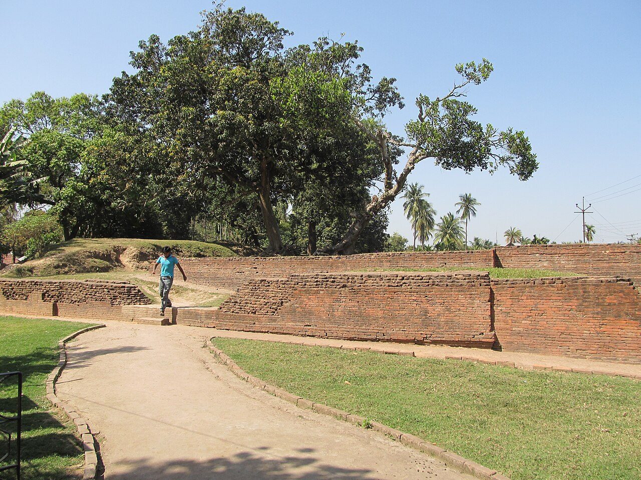
Chandraketugarh
Biswarup Ganguly · CC BY 3.0

A lost city that was looted before it was studied

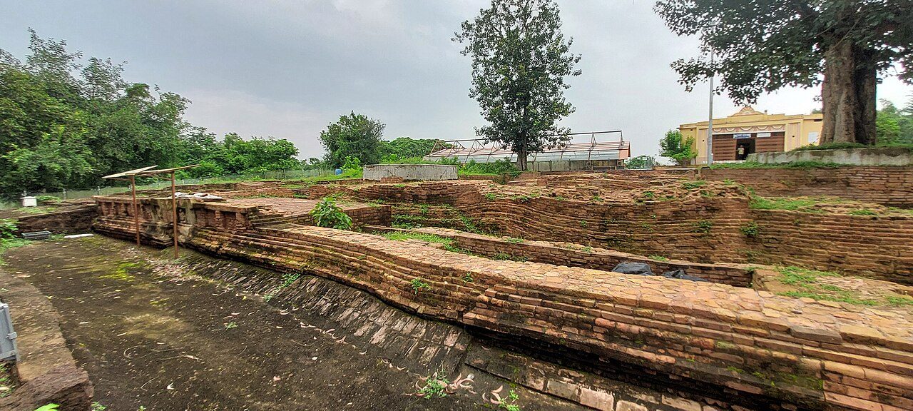
An hour from Kolkata, Chandraketugarh was an ancient urban and trading centre whose terracotta plaques are among the most detailed of early India: dancers, couples, animals and boats.

The Asutosh Museum began excavating in 1957, but many objects had already passed through the antiquities market and left the country. The mound in the photograph, known locally as Khana Mihir's mound, is one of the few visible traces.

214metres, dock basin LothalAhmedabad district, Gujarat
c. 2400 BCE
22.5214, 72.2494Open in Maps →
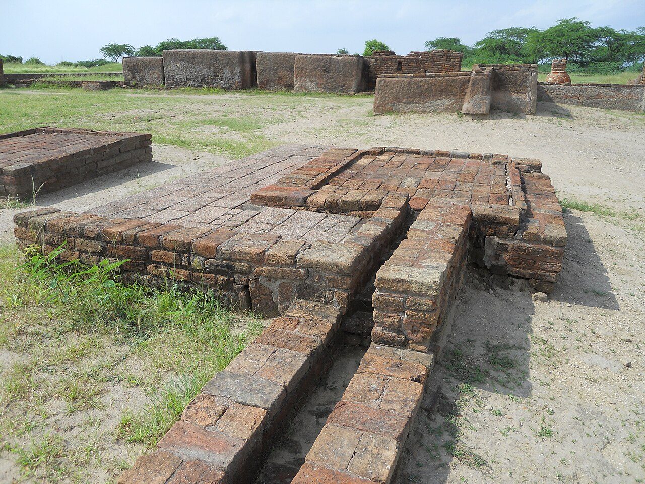
Lothal
Abhilashdvbk · CC BY-SA 3.0

A Harappan port with a basin for boats

Excavated from 1955, Lothal was a Harappan town on a river near the Gulf of Khambhat. Its most debated feature is a large brick-lined basin, about 214 metres long, that the excavator identified as a dock with a sluice.

Some archaeologists have argued it was a reservoir instead. Either way, the town had a bead-making industry, a warehouse and drains, and seals from the Persian Gulf show it traded overseas.

2021UNESCO World Heritage DholaviraKutch, Gujarat
c. 3000 — 1500 BCE
23.8886, 70.2136Open in Maps →
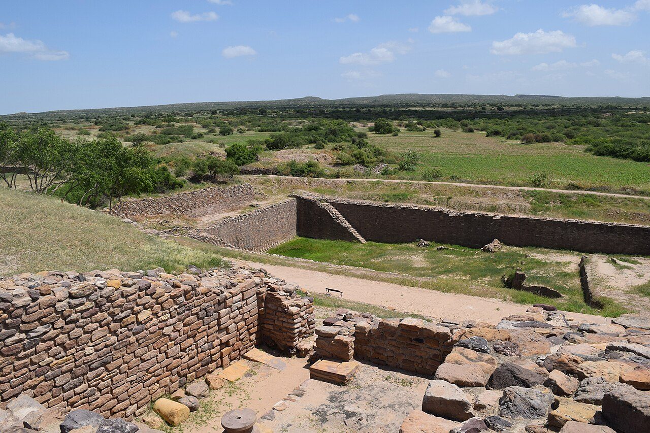
Dholavira
Lalit Gajjer · CC BY-SA 4.0

A desert city that cut its water tanks into rock

On Khadir island in the Rann of Kutch, Dholavira was a major Harappan city. Its builders dammed two seasonal streams and fed a chain of reservoirs around the city, several cut straight down into the bedrock.

Excavations from 1990 also found a set of large Indus script signs that had fallen near a gateway, often called the oldest signboard. The script is still undeciphered.

2,500years of layers Purana QilaNew Delhi
Mauryan — Mughal
28.6094, 77.2442Open in Maps →
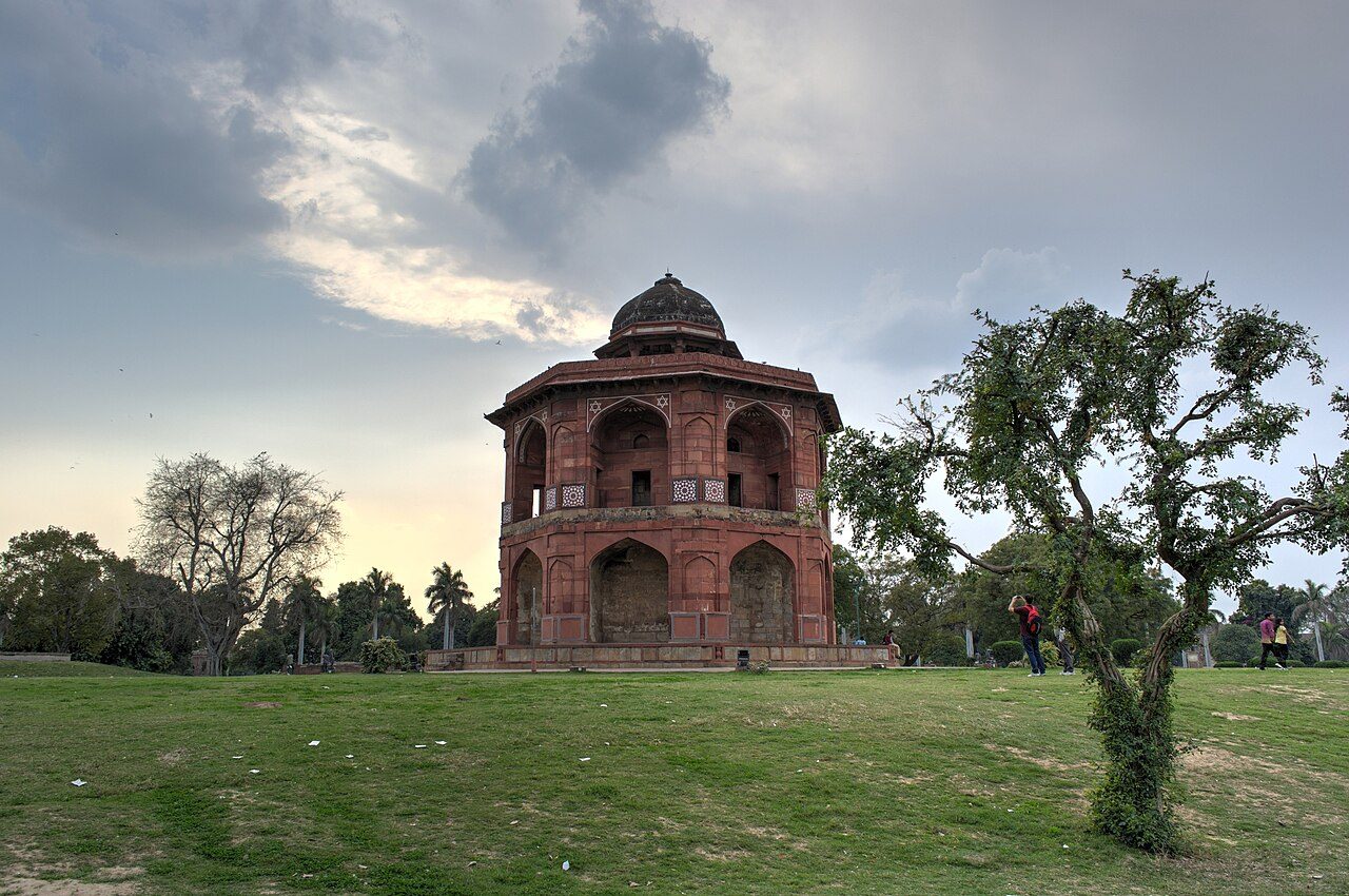
Purana Qila
Slyronit · CC BY-SA 4.0

One fort, many cities underneath

The walls are 16th century, finished under Sher Shah Suri and Humayun. Underneath, excavations since the 1950s have found layer after layer of people living on the same mound: Mughal, Sultanate, Rajput, Gupta, Kushan, Shunga and Mauryan, over grey painted pottery.

Tradition places Indraprastha, the Pandavas' city, here. That is not proven, but the mound has clearly been lived on for around two and a half thousand years.

1876first dug AdichanallurThoothukudi, Tamil Nadu
Iron Age
8.6279, 77.8732Open in Maps →
Adichanallur
Balurbala · CC BY-SA 4.0

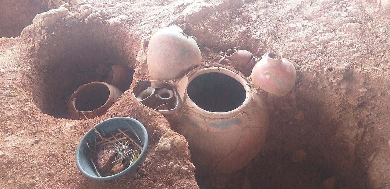
A riverbank lined with burial pots

Along the Thamirabarani river lies one of the largest urn-burial grounds in South India. People here buried their dead in large clay jars, with iron tools, weapons and bronze objects beside them.

It was first dug in 1876 and again in 1903, then from 2004 with modern methods. A site museum now lets visitors look down into excavated urns where they were found.

1960smoved above the flood NagarjunakondaPalnadu, Andhra Pradesh
3rd — 4th c. CE
16.5219, 79.2429Open in Maps →
Nagarjunakonda
Sabyk2001 · CC BY-SA 3.0

A Buddhist city that was moved to stay above water

The Ikshvaku capital Vijayapuri, with its stupas, monasteries and amphitheatre, was due to be drowned by the Nagarjunasagar dam. Archaeologists excavated the valley first.

Key monuments were dismantled and rebuilt on a hilltop that became an island when the reservoir filled. It is now an open-air museum reached by boat. Much of the original city lies under the lake.

Chapter Two

Monasteries in the Mounds

Seven Buddhist sites that looked like ordinary hillocks or village mounds until someone dug. Three of them still carry their builders' writing.

2000sexcavation began MoghalmariPaschim Medinipur, West Bengal
6th — 12th c. CE
21.9925, 87.2964Open in Maps →
Moghalmari
Pinakpani · CC BY 4.0

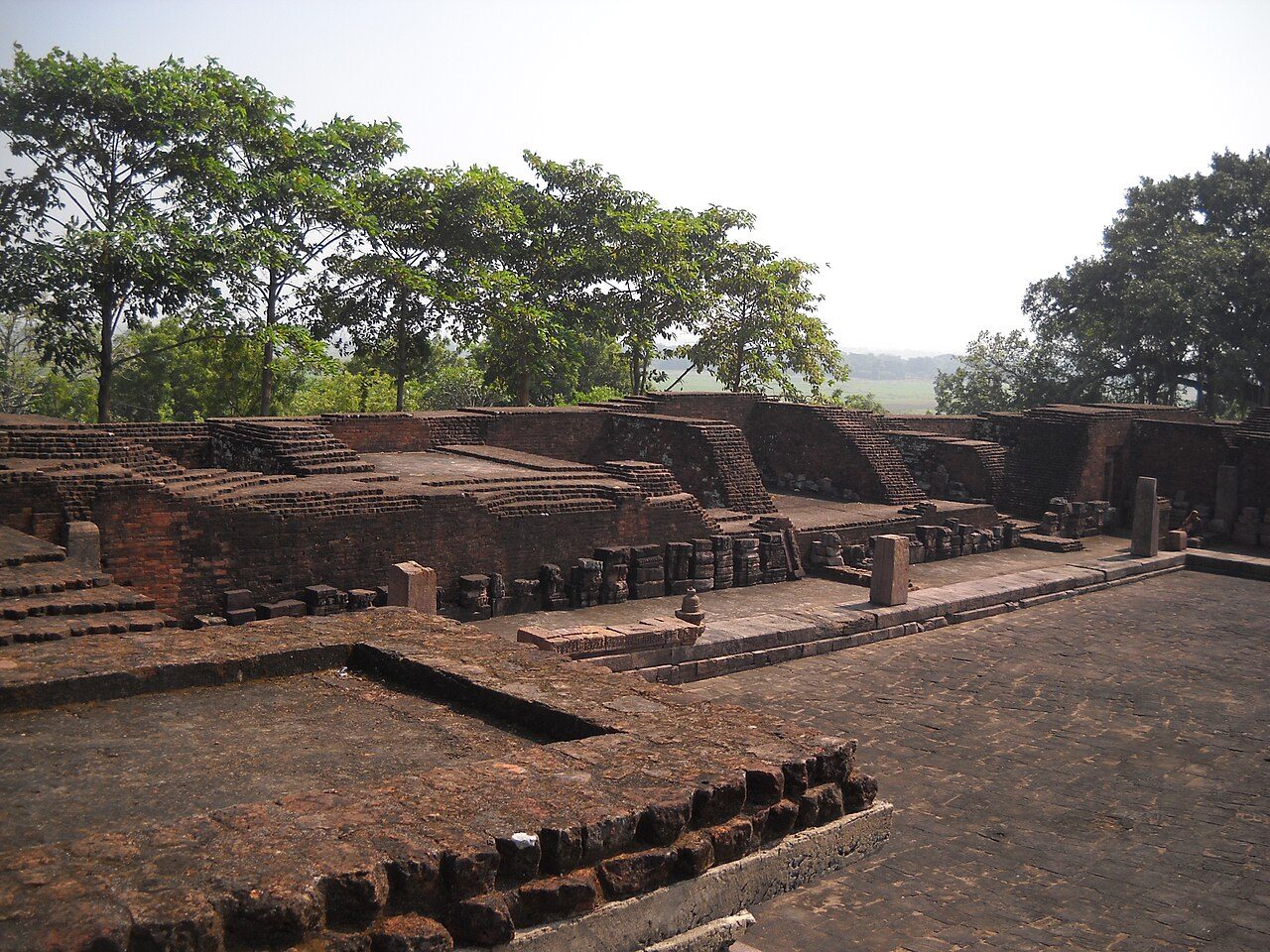
A village mound that was a monastery

For generations, Moghalmari was just a raised patch of ground in a Bengal village. Excavations from the early 2000s found a large Buddhist monastery beneath it, with a courtyard of monks' cells.

The digs uncovered surviving stucco decoration, sculptures and inscribed seals that name the monastery. It is now counted among the larger monastic sites of early Bengal.

1958excavation began RatnagiriJajpur, Odisha
5th — 13th c. CE
20.6412, 86.3353Open in Maps →
Ratnagiri
Mitrabhanu.panda · CC BY-SA 3.0

A doorway carved finely enough to stop visitors

On a hill above the Brahmani river, Ratnagiri was one of the great monasteries of eastern India. Excavations from 1958 to 1961 exposed a main stupa, hundreds of votive stupas and two monasteries.

The main monastery's stone doorway is carved with such fine detail that it is the site's most photographed object. Ratnagiri forms Odisha's Diamond Triangle with Lalitgiri and Udayagiri.

100+carved railing pieces SangholFatehgarh Sahib, Punjab
Kushan period
30.7839, 76.3889Open in Maps →
Sanghol
Ajay Tallam · CC BY-SA 2.0

A buried stack of carved stone

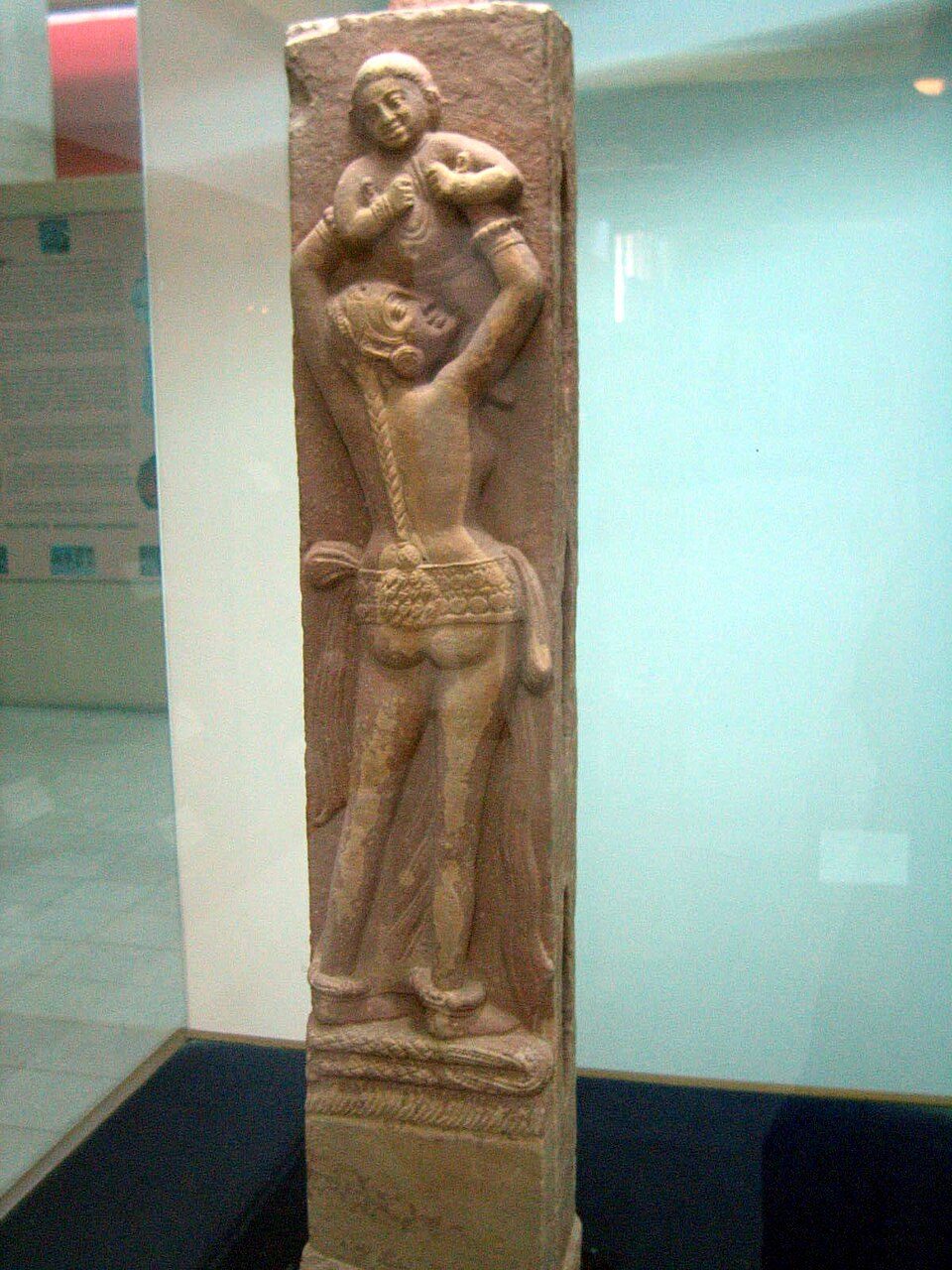
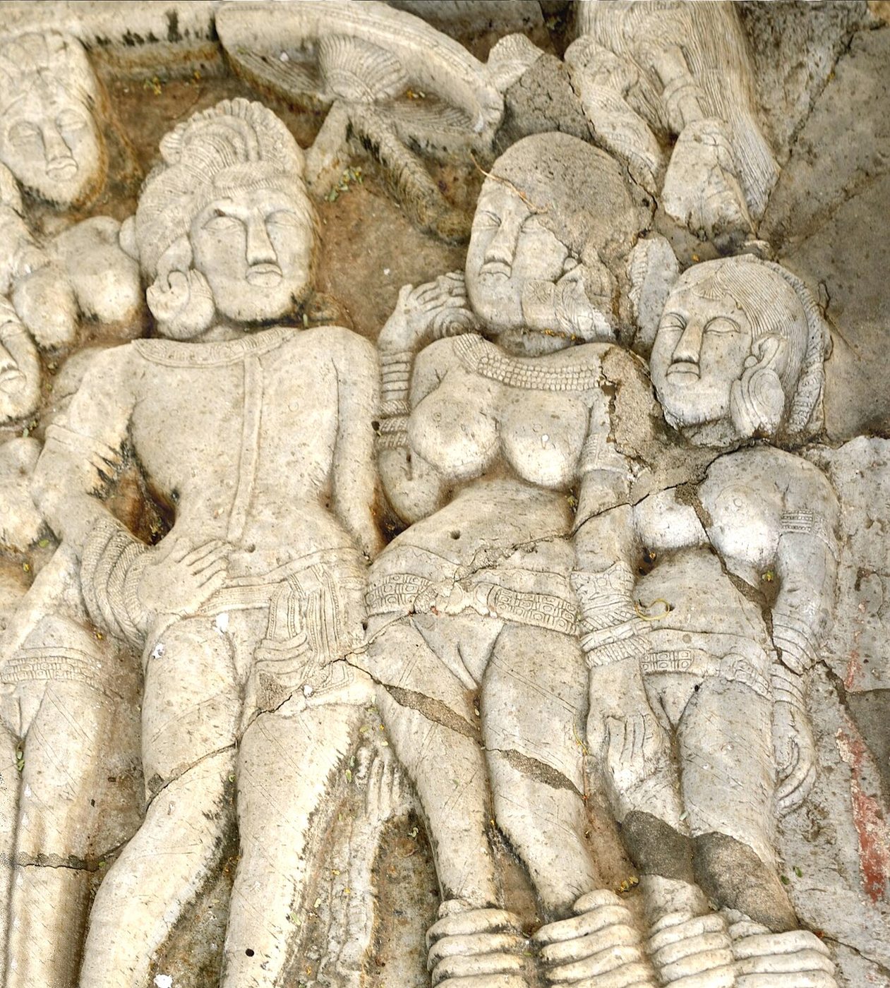
Punjab is rarely thought of as Buddhist country, but Sanghol had a stupa and a monastery. In 1985 excavators found a pit packed with more than a hundred pieces of carved red sandstone railing, in the style of Mathura.

The pieces had been laid in deliberately, possibly to protect them. They show women under trees, animals and scenes of daily life, and are now in the Sanghol museum.

427CE, founded c. NalandaNalanda, Bihar
5th — 12th c. CE
25.1353, 85.4426Open in Maps →
Nalanda
Odantapuribs · CC BY-SA 4.0

The university that came back out of the ground

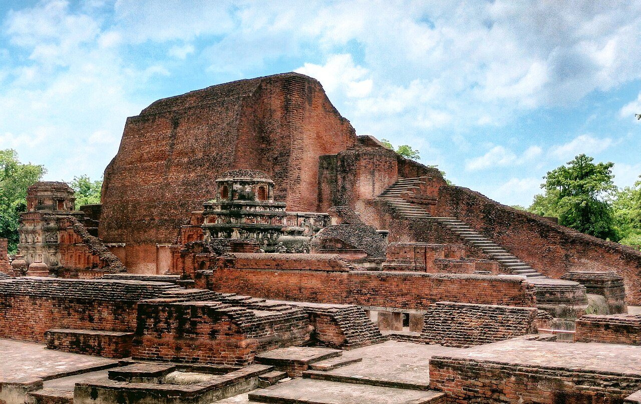
Founded under the Guptas, Nalanda drew students and teachers from across Asia, including the Chinese pilgrim Xuanzang. It was destroyed around the end of the 12th century, and its ruins disappeared under mounds.

Excavations from 1915 uncovered rows of brick monasteries and temples. Later accounts say its library burned for months; the figure is tradition. The excavated site has been a UNESCO World Heritage Site since 2016.

1873found by Cunningham BharhutSatna, Madhya Pradesh
2nd c. BCE
24.4469, 80.8460Open in Maps →
Bharhut
Pinakpani · CC BY-SA 4.0

Stories in stone, carried to Kolkata

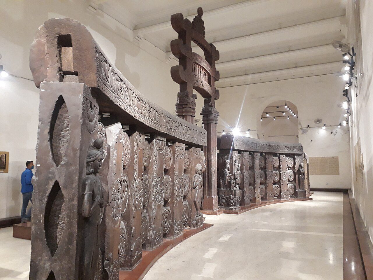
Alexander Cunningham found the remains of the Bharhut stupa in 1873. Its railings and gateway carry some of the earliest narrative Buddhist sculpture in India, many with labels naming the scene or the donor.

Villagers had been taking stones for building. Most surviving pieces were moved to the Indian Museum in Kolkata. Little stands at the site itself today.

1990sexcavated KanaganahalliKalaburagi, Karnataka
1st c. BCE — 3rd c. CE
16.8354, 76.9325Open in Maps →
Kanaganahalli
Ashokha · CC BY-SA 3.0

The portrait labelled Ashoka

Near Sannati on the Bhima river, excavations in the 1990s exposed a large stupa whose collapsed casing slabs were carved with scenes and rulers.

One shows a king under a parasol with an inscription reading Raya Asoko, King Ashoka. It is often described as the only portrait of Ashoka labelled with his name.

1898caskets found PiprahwaSiddharthnagar, Uttar Pradesh
c. 5th c. BCE onward
27.4430, 83.1278Open in Maps →
Piprahwa
SM7 · CC BY-SA 4.0

A casket that names the Buddha's relics

In 1898, digging into a stupa at Piprahwa, near the Nepal border, uncovered a stone coffer with relic caskets inside. One carries an inscription in Brahmi referring to relics of the Buddha and the Sakya clan.

Later excavations found more caskets deeper down. Some scholars identify the area with ancient Kapilavastu, the Buddha's home town; that identification is contested.

Chapter Three

Swallowed by Sand and Water

Four places where nature, or a nervous engineer, covered the monument. Each one has been uncovered at least once.

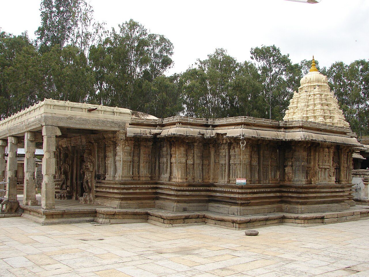
Dunesover the temples TalakadMysuru district, Karnataka
10th c. CE onward
12.2200, 77.0300Open in Maps →
Talakad
Dineshkannambadi · CC BY-SA 3.0

Temples dug out of the sand, then buried again

On a bend of the Kaveri, wind-blown sand has buried a whole group of temples. Some, like the Vaidyeshvara temple in the photograph, have been dug out. Others are still under the dunes.

Local tradition blames a curse laid by a queen in the 17th century. Geographers point to the river and a dam upstream. Either way, the sand keeps returning.

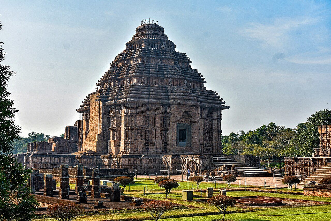
1903hall sealed with sand Konark Sun TemplePuri district, Odisha
13th c. CE
19.8875, 86.0947Open in Maps →
Konark Sun Temple
Subham9423 · CC BY-SA 4.0

The hall the British filled with sand

The main tower of the sun temple had already fallen. In 1903, fearing the assembly hall would collapse too, the authorities filled it with sand and sealed its doors.

For more than a century the interior stayed hidden. The Archaeological Survey of India has since begun the slow work of removing the sand and checking the structure.

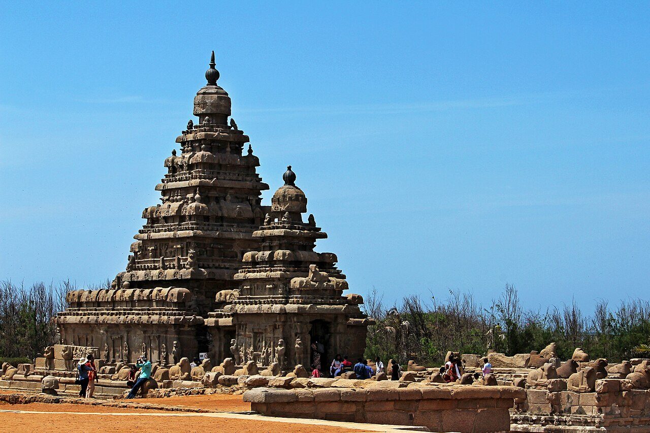
2004tsunami uncovered ruins Shore TempleMahabalipuram, Tamil Nadu
c. 700 CE
12.6164, 80.1986Open in Maps →
Shore Temple
Swarna1311 · CC BY-SA 4.0

What the sea showed for a moment

The Shore Temple is one of the oldest structural stone temples in South India. European travellers once wrote of seven pagodas on this coast, and only one stood above the water.

When the sea pulled back before the 2004 tsunami, people saw stone remains offshore, and the waves stripped sand from rock carvings on the beach. Underwater surveys since have reported structures off the coast.

Belowground level Underground Shiva TempleHampi, Karnataka
Vijayanagara period
15.3179, 76.4643Open in Maps →
Underground Shiva Temple
iMahesh · CC BY-SA 4.0

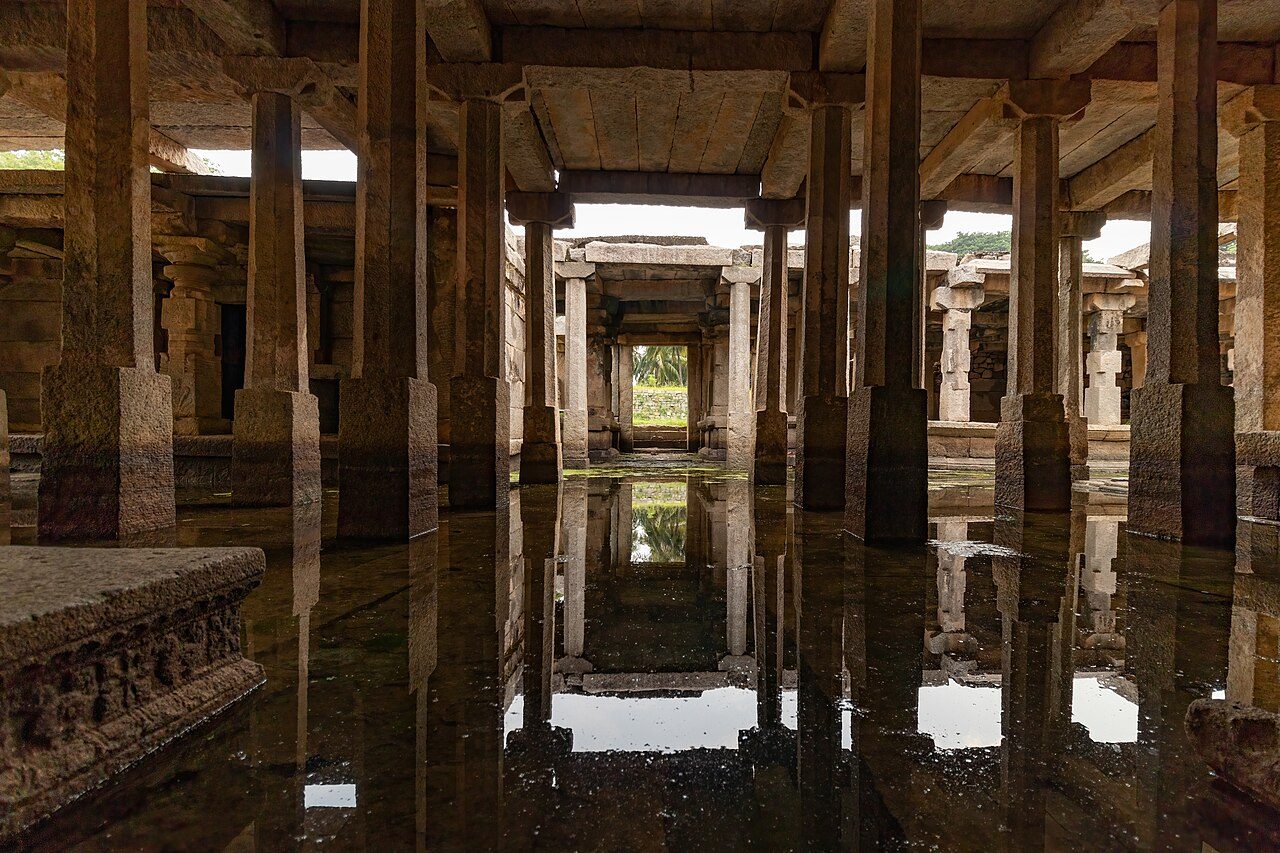
A temple you walk down into, ankle-deep

In Hampi's royal centre is a Shiva temple built below the level of the surrounding ground, reached by steps going down.

Groundwater seeps into its pillared halls, and for much of the year parts of the temple, including the sanctum, stand in water and cannot be entered.

Appendix

Image Credits

Every photograph here is used under a Creative Commons licence. Attribution is a condition of those licences, not a courtesy — this page is how that condition is met.

SitePhotographerLicenceFile
KeezhadiSsriram mtCC BY-SA 4.0source
SirpurMohnish1208CC BY-SA 3.0source
ChandraketugarhBiswarup GangulyCC BY 3.0source
LothalAbhilashdvbkCC BY-SA 3.0source
DholaviraLalit GajjerCC BY-SA 4.0source
Purana QilaSlyronitCC BY-SA 4.0source
AdichanallurBalurbalaCC BY-SA 4.0source
NagarjunakondaSabyk2001CC BY-SA 3.0source
MoghalmariPinakpaniCC BY 4.0source
RatnagiriMitrabhanu.pandaCC BY-SA 3.0source
SangholAjay TallamCC BY-SA 2.0source
NalandaOdantapuribsCC BY-SA 4.0source
BharhutPinakpaniCC BY-SA 4.0source
KanaganahalliAshokhaCC BY-SA 3.0source
PiprahwaSM7CC BY-SA 4.0source
TalakadDineshkannambadiCC BY-SA 3.0source
Konark Sun TempleSubham9423CC BY-SA 4.0source
Shore TempleSwarna1311CC BY-SA 4.0source
Underground Shiva TempleiMaheshCC BY-SA 4.0source

Most images are licensed CC BY-SA, which requires that adaptations be shared under the same terms. This guide is given away free, which satisfies that. Do not sell it without re-checking each licence individually.